The Problem
Landmines and unexploded ordinance (UXO) have catastrophic impacts throughout the world. UNESCO reports that more than 1 million children, women, and men have been killed or maimed by exploding landmines since 1975; the vast majority, 80%, being civilians. In 2017 there were some 7,239 recorded casualties of which at least 2,452 were children. Today it is estimated that there are 110 million landmines buried in 64 countries. The effects of these devices, and their removal, have a devastating impact on the environment as well, rendering the land effectively useless for agriculture and grazing.
This problem was largely created by my generation, and I want to use my skills and experience to do something about it. (link to presentation and call to action)
Anti-personnel landmines do not discriminate between soldiers and civilians in any region. Landmines and UXO remain buried long after the armed conflict has ended. There are an estimated 64 countries, notably developing nations, with significant numbers of unexploded and dangerous devices still in place hidden in terrains ranging from desert to rain forest to coastline to mountain. These include countries in South America (e.g., Chile, Peru, Colombia), Africa (e.g., Angola, Mozambique, Somalia, Sudan, Ethiopia, Eritrea, Rwanda), Southeast Asia (e.g., Cambodia), the Middle East (e.g., Afghanistan, Egypt, Iraq, Iran, Israel), and Eastern Europe (e.g., Bosnia, Herzegovina, Croatia).
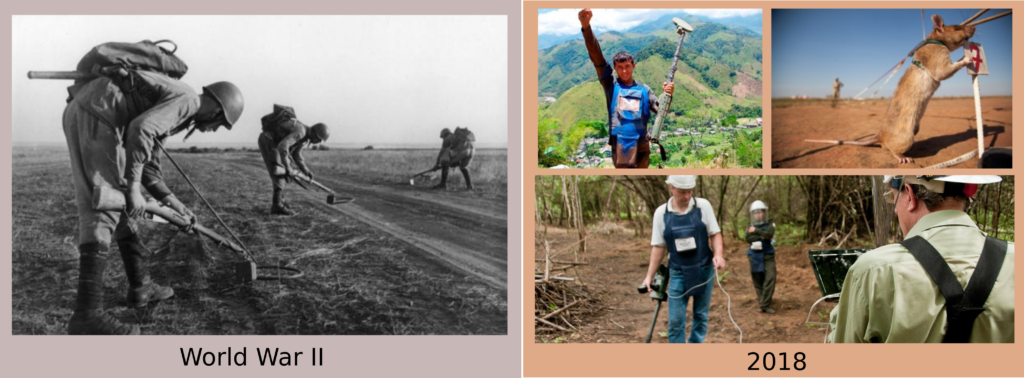
People working to locate landmines and UXO agree there is no single sensor technology capable of reliable detection in any particular landscape or setting. Numerous innovative techniques have been developed, including sniffer rats, glowing bacteria, metal detectors, laser and radar devices, flailing armored tanks, robots and drones. These technologies are appropriate for specific situations and environments. However, landmines and UXO are made from a variety of materials and have been buried in all kinds of terrain.
Toward a solution
A likely path to progress, then, is to employ multiple sensing technologies, create overlapping map layers, and merge the disparate data types. I propose to take full advantage of recent and continuing advances in sensor, robotics, and computing technologies to employ a diverse multi-sensor approach to remotely and automatically survey and locate mines with high resolution on the hectare scale. This is a focused application of all of the meso-scale mapping tools at our disposal.
As a key technology to make the best use of these measurements, I propose to use the power of AI to learn the style of nature described by these layers of information to recognize what is normal and what doesn't belong and in so doing to detect landmines and UXO hidden within a natural scene. These maps of potential mines can then be used by field teams for verification and subsequent de-mining with the minimum risk.
As this work progresses, the process of landmine detection and removal will advance significantly, making it possible for people to once again live and work on their land. As new sensor technology development continues to accelerate, in 5 years time multiple informative data types will be available from robots and drones to bear on the landmine and UXO detection problem. This AI approach is by nature extensible to these new data types and experience allowing them to be brought into service. Bringing new quantifiable metrics for risk to this problem will immediately improve effectiveness, speed, and safety of demining.